


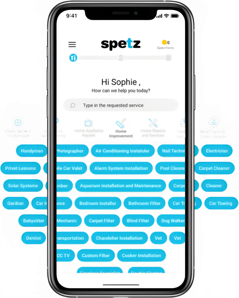
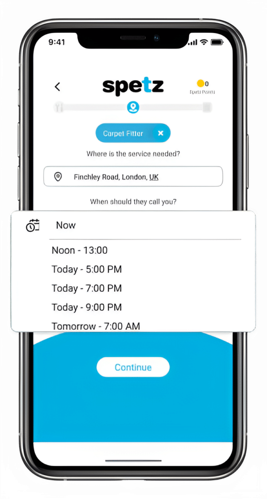
Simply enter the service you need, and your details then press "Spetz-it".
You'll be connected immediately to a nearby top-rated service provider.
Your rating is important. So you can help other customers get the best specialist too.
Hiring the best drone services near you involves careful research and consideration to ensure you find a reputable and skilled drone operator who can meet your specific needs. Drones are used in various industries for photography, videography, surveying, inspections, and more. Here’s a step-by-step guide to help you hire the best drone services:
1. Define Your Needs:
Determine exactly what you need the drone services for. Are you looking for aerial photography, videography, mapping, inspections, or something else?
2. Research Local Providers:
Search online for drone service providers in your area. Check directories, websites, and social media platforms to find local companies or freelancers offering drone services.
3. Check Experience and Expertise:
Look for drone operators with experience in your specific industry or use case. Check their portfolio or examples of past work to assess their skills and expertise.
4. Verify Licensing and Certifications:
Drone operators need to be licensed by aviation authorities in many countries. Make sure the operators you’re considering have the necessary licenses and certifications to operate drones legally.
5. Read Reviews and Testimonials:
Look for reviews and testimonials from previous clients. This can give you insights into the quality of their work, professionalism, and reliability.
6. Ask for References:
Request references from the drone service providers. Contact these references to get firsthand feedback on their experience working with the operator.
7. Assess Equipment Quality:
Inquire about the type of drones and equipment the operators use. Modern and well-maintained equipment is important for high-quality results.
8. Discuss Insurance Coverage:
Make sure the drone operator has liability insurance to cover any potential damages or accidents that might occur during the operation.
9. Discuss Data Security:
If your project involves capturing sensitive or proprietary information, discuss data security measures to ensure your information is handled appropriately.
10. Request Samples of Work:
Ask for samples of work that are relevant to your needs. This could include aerial photographs, videos, or maps that showcase the operator’s capabilities.
11. Inquire About Post-Processing:
If your project requires post-processing of the drone data (such as editing aerial images or creating maps), discuss whether the operator offers these services.
12. Discuss Location and Access:
Share details about the location where you need the drone services and inquire about any potential restrictions or challenges related to flying drones in that area.
13. Get Multiple Quotes:
Contact multiple drone service providers to get quotes for your project. Compare their pricing, services, and terms to make an informed decision.
14. Discuss Project Timeline:
Inquire about the operator’s availability and the estimated timeline for completing your project.
15. Check Communication Skills:
Effective communication is crucial when working with drone operators. Ensure they are responsive and can clearly explain their approach to your project.
16. Review Contract Terms:
Once you’ve chosen a drone service provider, review the contract thoroughly. Make sure it includes all the details of the project, pricing, and terms.
17. Clarify Deliverables:
Discuss the expected deliverables, whether it’s high-resolution images, edited videos, maps, or other data.
18. Discuss Weather Contingencies:
Aerial operations can be impacted by weather conditions. Discuss how the operator handles rescheduling or delays due to weather.
19. Ensure Safety Practices:
Ask about the operator’s safety practices, such as pre-flight checks, flight protocols, and emergency procedures.
20. Trust Your Instincts:
Choose a drone service provider you feel comfortable working with, who understands your needs, and who demonstrates professionalism and expertise.
By following these steps and conducting thorough research, you can hire the best drone services near you to ensure high-quality aerial photography, videography, mapping, inspections, or any other drone-related needs you have.
Drone services refer to the professional use of unmanned aerial vehicles (UAVs), commonly known as drones, for a variety of applications across different industries. Drones are equipped with cameras and other sensors that allow them to capture high-resolution images, videos, and data from aerial perspectives. Drone services offer a range of capabilities that can be utilized for tasks that were once expensive, time-consuming, or even dangerous when conducted through traditional methods. Here’s what drone services are and what they can do:
1. Aerial Photography and Videography:
Drones are widely used to capture stunning aerial photographs and videos for various purposes, such as real estate marketing, event coverage, tourism promotions, and filmmaking.
2. Surveying and Mapping:
Drones equipped with specialized cameras and software can create accurate topographic maps, 3D models, and orthomosaic images for industries like construction, agriculture, urban planning, and land surveying.
3. Inspections:
Drones are employed for inspecting hard-to-reach or hazardous areas, such as bridges, power lines, cell towers, pipelines, and industrial structures. They provide visual data for maintenance assessments and identifying potential issues.
4. Agriculture and Crop Monitoring:
Drones equipped with multispectral cameras can monitor crop health, identify irrigation issues, and assess the need for fertilizers or pesticides in precision agriculture.
5. Search and Rescue Operations:
Drones equipped with thermal cameras and other sensors aid search and rescue teams in locating missing persons, monitoring disaster areas, and identifying survivors.
6. Environmental Monitoring:
Drones are used to monitor environmental changes, such as deforestation, wildlife tracking, and assessing the impact of natural disasters.
7. Infrastructure Inspection:
Drones provide efficient inspections of infrastructure like roads, railways, bridges, and dams, helping to identify cracks, corrosion, and other potential hazards.
8. Real Estate and Property Management:
Drones capture aerial views of properties for real estate listings, allowing potential buyers to get a comprehensive view of the property and its surroundings.
9. Event Coverage:
Drones capture dynamic and captivating aerial footage of weddings, concerts, sports events, and other gatherings.
10. Construction Site Monitoring:
Drones offer a bird’s-eye view of construction sites, aiding in progress tracking, site planning, and identifying potential issues.
11. Archaeological Surveys:
Drones can assist in archaeological surveys by capturing aerial imagery and creating detailed maps of archaeological sites.
12. Film and Entertainment Industry:
Drones are used in filmmaking to capture aerial scenes, enhancing cinematography with unique perspectives and shots.
13. Wildlife Conservation:
Drones assist researchers in studying wildlife behavior, population monitoring, and anti-poaching efforts in remote or hard-to-reach areas.
14. Disaster Response and Assessment:
Drones provide rapid visual assessments of disaster-stricken areas, helping emergency responders determine the extent of damage and plan relief efforts.
15. Geographical Exploration:
Drones support geographical exploration by collecting data in challenging terrains, such as mountains, glaciers, and remote islands.
16. Roof Inspections:
Drones offer a safer and more efficient way to inspect roofs for damage, allowing for detailed assessments without risking human safety.
17. Advertising and Marketing:
Drones capture captivating aerial shots for advertising campaigns, creating eye-catching visuals for various products and services.
18. Environmental Conservation:
Drones assist in monitoring ecosystems, tracking wildlife movements, and assessing environmental changes for conservation efforts.
19. Coastal and Marine Research:
Drones collect data on coastal erosion, marine life, water quality, and oceanography.
20. Educational and Research Purposes:
Drones are used in educational settings for teaching students about aviation, technology, geography, and other subjects.
Drone services play a pivotal role in modern industries by providing efficient, cost-effective, and data-rich solutions for various tasks that benefit from aerial perspectives and remote sensing.
Drone services offer a wide range of capabilities that can assist various industries in completing tasks more efficiently, safely, and cost-effectively. Here are some of the jobs that drone services can help with:
1. Aerial Photography and Videography:
Capture stunning aerial images and videos for real estate listings, event coverage, tourism promotion, filmmaking, and more.
2. Surveying and Mapping:
Create accurate maps, 3D models, and topographic data for construction sites, land surveying, agriculture, urban planning, and environmental monitoring.
3. Inspections:
Perform visual inspections of infrastructure, such as bridges, power lines, pipelines, and industrial structures, to identify issues without putting human inspectors at risk.
4. Agriculture and Crop Monitoring:
Monitor crop health, assess irrigation needs, and optimize agricultural practices using multispectral and thermal cameras.
5. Search and Rescue Operations:
Assist search and rescue teams in locating missing persons, monitoring disaster areas, and identifying survivors through thermal imaging and aerial search capabilities.
6. Environmental Monitoring:
Monitor environmental changes, deforestation, wildlife populations, and natural disasters to aid conservation efforts.
7. Infrastructure Inspection:
Inspect roads, railways, bridges, dams, and other infrastructure for cracks, corrosion, and structural integrity.
8. Real Estate and Property Management:
Provide aerial views of properties for real estate listings, giving potential buyers a comprehensive perspective of the property and its surroundings.
9. Event Coverage:
Capture dynamic aerial footage of weddings, concerts, sports events, festivals, and other gatherings.
10. Construction Site Monitoring:
Monitor construction progress, site planning, and safety compliance by capturing regular aerial images and videos.
11. Archaeological Surveys:
Conduct archaeological surveys by capturing high-resolution aerial imagery of sites to aid in research and documentation.
12. Film and Entertainment Industry:
Capture cinematic aerial shots for films, TV shows, commercials, and promotional videos.
13. Wildlife Conservation:
Monitor wildlife behavior, track populations, and support anti-poaching efforts in remote or challenging environments.
14. Disaster Response and Assessment:
Perform rapid visual assessments of disaster-stricken areas to assist emergency responders in assessing damage and planning relief efforts.
15. Geographical Exploration:
Collect data in remote or challenging terrains for geographical exploration and research purposes.
16. Roof Inspections:
Safely and efficiently inspect roofs for damage, wear, and maintenance needs without the need for physical access.
17. Advertising and Marketing:
Create captivating aerial visuals for advertising campaigns, showcasing products, services, and brands from unique perspectives.
18. Environmental Conservation:
Monitor ecosystems, track changes, and assess the impact of human activities on the environment.
19. Coastal and Marine Research:
Gather data on coastal erosion, marine life, water quality, and oceanography to support marine research and conservation efforts.
20. Educational and Research Purposes:
Integrate drones into educational curricula to teach students about aviation, technology, geography, environmental science, and more.
The versatility and capabilities of drones make them valuable tools across a wide range of industries, offering innovative solutions to complex challenges and enhancing various aspects of professional operations.
The cost of drone services in Australia can vary widely based on factors such as the type of service, the complexity of the task, the location, the equipment used, the expertise of the operator, and the duration of the project. As of my last knowledge update in September 2021, here’s a general overview of the potential costs associated with different types of drone services in Australia:
1. Aerial Photography and Videography:
For aerial photography and videography services, prices can range from AUD $200 to $1,000 or more per session, depending on the duration of the shoot, the number of images or videos required, and the level of editing.
2. Surveying and Mapping:
The cost of drone mapping and surveying services can vary widely based on the size of the area to be mapped, the complexity of the terrain, and the accuracy required. Prices can start from around AUD $500 for basic mapping and increase significantly for larger or more intricate projects.
3. Inspections:
The cost of drone inspections depends on the type of infrastructure being inspected, the complexity of the inspection, and the expertise needed. Prices can range from AUD $300 to $1,500 or more for more complex industrial inspections.
4. Agriculture and Crop Monitoring:
Drone services for agriculture and crop monitoring can range from AUD $300 to $1,000 or more per session, depending on the size of the field and the level of data analysis required.
5. Search and Rescue Operations:
Prices for drone services in search and rescue operations can vary based on the nature of the operation, the equipment used (including thermal cameras), and the complexity of the search area. Costs can start from AUD $500 and increase based on requirements.
6. Event Coverage:
Drone services for event coverage can start from around AUD $300 to $800 or more, depending on the duration of coverage, the event’s location, and the deliverables.
7. Construction Site Monitoring:
For construction site monitoring, prices can start from AUD $300 to $1,000 or more, depending on the frequency of monitoring and the extent of the site.
It’s important to note that these are rough estimates, and actual costs can vary based on a variety of factors. When seeking drone services, it’s recommended to reach out to multiple providers to obtain quotes tailored to your specific project needs. Be sure to discuss the scope of work, deliverables, equipment used, and any additional fees that might apply. Additionally, prices may have changed since my last update in September 2021, so it’s advisable to research current rates in your area.
When hiring local drone services, asking the right questions can help you assess the operator’s expertise, equipment, capabilities, and professionalism. Here are some important questions to ask when evaluating drone service providers:
1. Are You Licensed and Certified to Operate Drones?
Ensure that the operator holds the necessary licenses and certifications required by aviation authorities in your country.
2. What Types of Drones and Equipment Do You Use?
Inquire about the types of drones, cameras, sensors, and other equipment the operator uses for different tasks.
3. Can You Provide Examples of Your Work?
Ask for a portfolio or examples of projects they’ve completed that are similar to what you need.
4. What Experience Do You Have in This Industry?
Inquire about their experience in providing drone services for your specific industry or type of project.
5. Do You Have Liability Insurance?
Confirm that the operator has liability insurance to cover any potential damages or accidents that might occur during the drone operation.
6. Can You Provide References from Previous Clients?
Request references from past clients to get feedback on the operator’s professionalism, communication, and quality of work.
7. What’s Your Pricing Structure?
Discuss the pricing for the specific services you need, including any additional costs or fees that may apply.
8. Do You Have Experience with Regulatory Approvals or Permits?
If your project requires regulatory approvals or permits for flying drones in certain areas, ask about their experience in obtaining these permissions.
9. How Do You Ensure Safety During Drone Operations?
Inquire about their safety protocols, pre-flight checks, and emergency procedures to ensure safe drone operations.
10. What Software and Tools Do You Use for Data Processing?
Ask about the software and tools they use to process and analyze data collected by the drones.
11. What’s Your Approach to Data Security?
If your project involves sensitive data, discuss their measures for data security and confidentiality.
12. Can You Handle Editing and Post-Processing?
If your project involves editing and post-processing of images or videos, inquire if they offer these services.
13. How Do You Handle Weather Conditions?
Ask about their policies for rescheduling or handling drone operations in adverse weather conditions.
14. Can You Provide a Detailed Project Timeline?
Discuss the estimated timeline for your project, including planning, execution, and delivery of results.
15. Do You Have Experience in [Your Specific Project]?
If your project has unique requirements, inquire about their experience with similar projects and challenges.
16. How Do You Communicate During the Project?
Understand their communication process, including how often you can expect updates and how you can contact them.
17. What Deliverables Can I Expect?
Clarify the type and format of deliverables you’ll receive, such as images, videos, maps, or reports.
18. Do You Offer Customization of Services?
Discuss whether they can tailor their services to meet your specific needs and objectives.
19. What Happens if There’s a Technical Issue During the Operation?
Inquire about their procedures for addressing technical issues that might arise during drone operations.
20. Are You Familiar with Local Regulations and No-Fly Zones?
Confirm that the operator is knowledgeable about local drone regulations and no-fly zones to ensure compliance.
Asking these questions will help you gather essential information and make an informed decision when choosing a local drone service provider. It’s important to find a provider that aligns with your project requirements and can deliver high-quality results safely and professionally.
Enjoy from unlimited access to your service provider’s contact details, ratings, certificates and more.
Scan This Code
Scan This Code